
The CPS School Tiers map can be found here.
The same tier info is also used on the CPS School Locator.
I think the information Derek is sharing could be applied by civic tech volunteers in other cities and working on other projects.
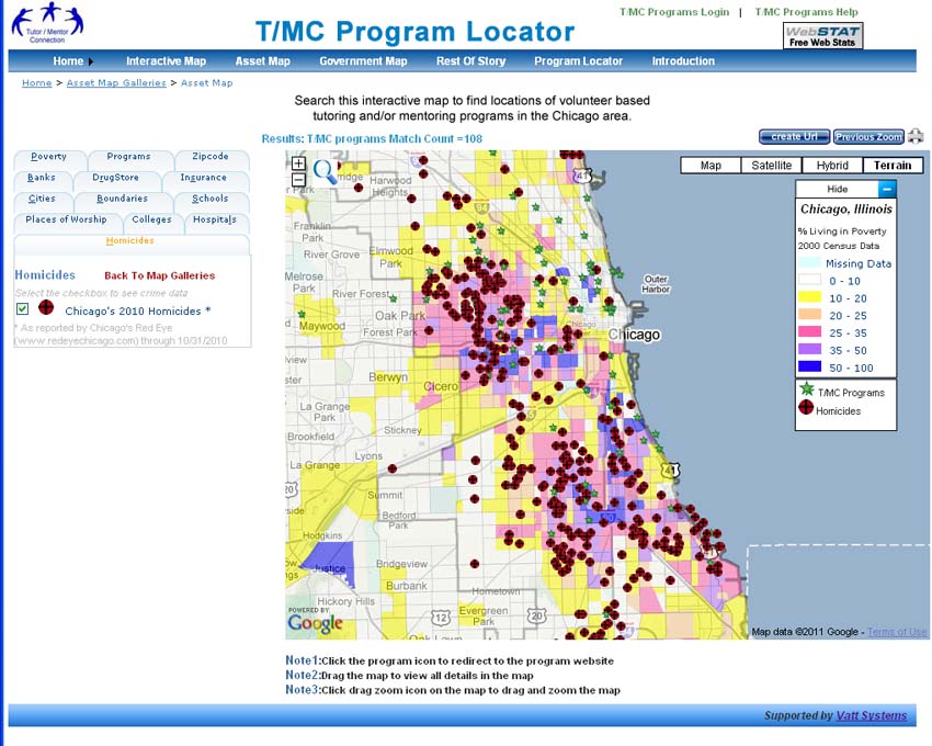
The Program Locator is part of a project started in 1993, intended to identify all non-school, volunteer-based tutor and mentor programs in the Chicago region and share that information in on-going public awareness activities intended to draw resources and ideas to existing programs, help parents, volunteers and donors find programs, and help people see where more programs are needed.

In 1998 we began putting the list of programs on line, pointing to program web sites, which we felt would have much more updated information than what we could provide in a directory. It could also be found by more people.

Unfortunately, this feature has not worked since 2013 and even in the late 2000s we had too few dollars to train programs to use this effectively.

Our goal was to create PDF essays, like this Shoppers Guide, to educate programs and resource providers, so they could make informed decisions on which programs to support. In some cases, there are almost no choices in some zip codes, so you need to help which ever programs are there become great at what they do. That take time and perseverance.
This page contains articles that show ways to use the Program Locator.
I've not found many using maps this way, to draw needed support to organizations who are already doing needed work in different parts of a city. Yet, I believe what I'm piloting can, and should, be applied in cities throughout the world.
Read more stories about my use of maps, on this blog, and on the Tutor/Mentor blog. See history of my use of maps, and current status, on this wiki page.
So, as I look at what Derek and others are doing with GIS technology, I hope to find people with similar talent, or some dollars, who will help me upgrade what I've been doing for almost 24 years.
No comments:
Post a Comment