Monday, May 26, 2014

Create Map Stories following Negative News

Throughout this blog and the Tutor/Mentor Blog I show how maps can be created to focus attention and resources on places in Chicago where bad things are happening to good people.

Maps can be created using the Tutor/Mentor Program Locator, or by using other map resources, such as this homicide map hosted by the Chicago SunTimes.

If you browse this blog you'll see other mapping platforms that can be used to create images for blogs and social media articles. These are tools that youth and adult volunteers could use in creating map stories that leverage the attention created by traditional media coverage of negative news. Such stories, if repeated over and over, could begin to motivate adults in different parts of the Chicago region (or in other cities) to provide the on-going flow of resources that are needed to create mentor-rich programs and learning opportunities for K-12 youth in neighborhoods where lack of opportunity contributes to lack of hope, which contributes to many of the negatives that are reported too often in the media.

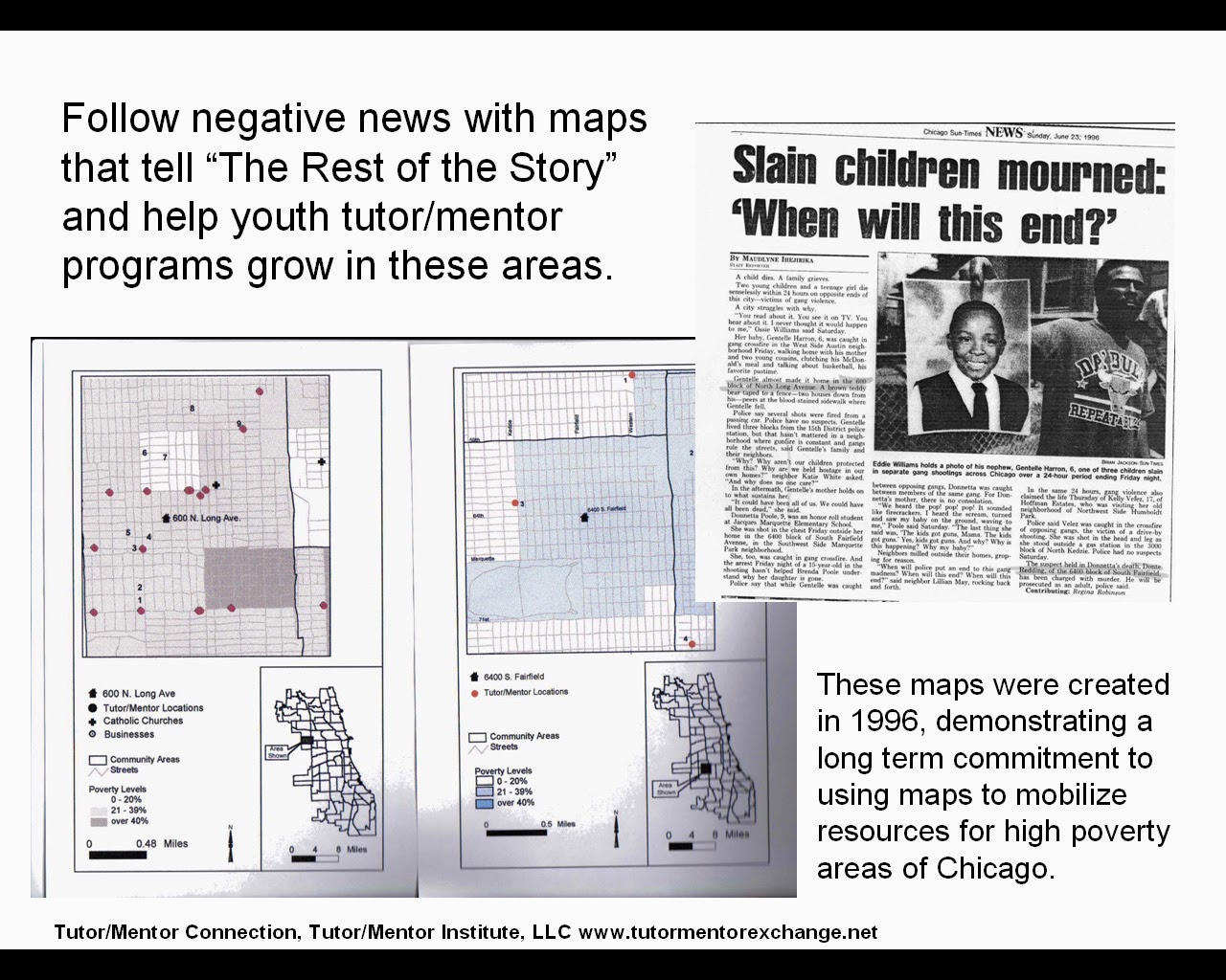
See this album for map stories from the 1990s and this Map Gallery for stories from between 2008 and 2011.

If you're already creating map stories for the purpose of drawing resources to neighborhoods, point to this list of Chicago tutoring and/or mentoring programs as you call on leaders to provide resources so your stories are helping existing programs grow.

Share your stories with me on Twitter @tutormentorteam or on Facebook in this group.

Friday, May 2, 2014

How is the Chicago Tutor/Mentor Program Locator Supposed to Work?

If you've visited the Chicago Tutor/Mentor Program Locator recently you'll see that some features, such as the boundary overlays, the zip code overlay, and the political district overlays, do not work. We're also having trouble adding new program information. This is all a result of Google changing how sites like mine interface with their map, and the fact that I don't have any money, or tech talent, to fix the problem.

If you want to know how this should work, visit the Chicago Public Schools "School Locator" page. It may take you a while to figure out how this works, but on the left side is a label that says "political overlays". Click on any of these and you'll see political district outlines on the map.

Now on the Tutor/Mentor Program locator, you'd be able to use a drop down menu to zoom into a specific district or geographic areas. I don't see this on the CPS locator, but I really like the way the technology works.

Of course, having a great map-directory is only useful if many people are using the maps to tell stories that draw needed resources into school neighborhoods so families and schools have more help encouraging youth to become active learners who take a greater responsibility for their own learning, and their own futures.

If you are creating map stories using this information please post a link to this article so others can learn from how you are using the maps.