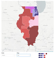
Every 10 years state political district maps are re drawn, based on the new Census information. Across the country Democratic and Republican party leaders try to "gerrymander" the maps to favor one party or another.
This platform provides maps for every state, showing maps favoring one party or the other, plus an recommended "fair map".
Use the search bar under the map to find your state, then to see the three versions of the map. Which will your state choose?
